Overview
The BLK ARC system represents a cutting-edge solution in the realm of autonomous scanning and navigation technologies, designed for versatility and efficiency in data collection. It integrates advanced features like remote user operation, offline path planning, GrandSLAM technology, and dual scanning modes, all aimed at optimizing the mapping and surveying process across varied environments.
Key Highlights
- Remote User Operation: Enables users to plan and execute missions from afar, be it from an office or the field, significantly enhancing safety by minimizing the need to enter hazardous areas.
- Offline Path Planning: Leverages Leica Cyclone 3DR software to create and modify missions in any setting, ensuring flexibility and precision in mission planning without the need for an active internet connection.
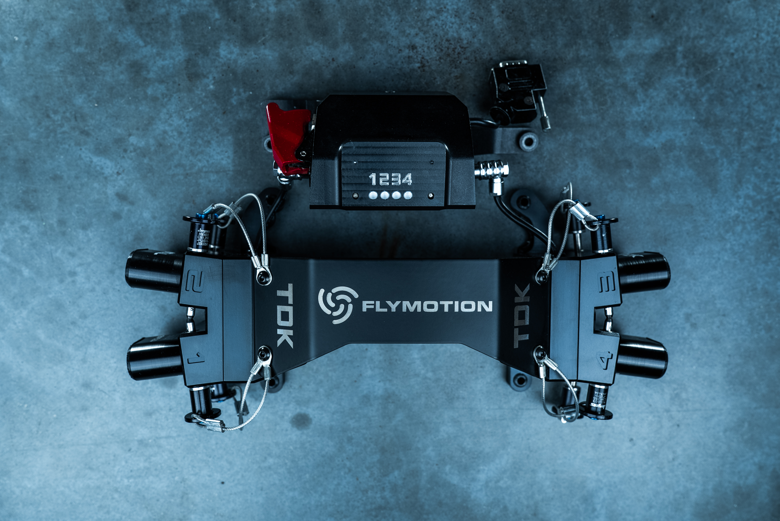
- GrandSLAM Technology: A sophisticated integration of LiDAR SLAM, Visual SLAM, and an IMU for fully autonomous scanning and robotic navigation, providing accurate data collection in complex environments.
- Versatile Scanning Modes: The BLK ARC can operate in both static and mobile scanning modes within a single mission, with seamless registration of all data types to streamline the surveying process.
- LiDAR Module Protection: Features a U-bar designed to safeguard the BLK ARC module when attached to its robotic carrier, ensuring durability and protection during operation.
- User-Friendly Interface: Offers an intuitive, browser-based application (BLK ARC UI) for easy control and management of the BLK ARC system, enhancing user experience and efficiency.
- Cloud Integration: Direct upload capability to HxDR, a cloud-based platform for data storage, visualization, and collaboration, facilitating easy access and sharing of collected data.
Key Specifications
- Remote Operation & Planning: Facilitates mission planning and execution from remote locations, enhancing operational safety and convenience.
- GrandSLAM Technology: Employs a combination of LiDAR SLAM, Visual SLAM, and IMU for advanced autonomous navigation and scanning capabilities.
- Scanning Modes: Supports both static and mobile scanning modes in a single mission, with automatic data registration.
- Protection & Durability: Includes a protective U-bar for the LiDAR module, ensuring safety during transportation and operation.
- Ease of Use: Features a simple, browser-based user interface for straightforward system management.
- Cloud Platform Compatibility: Allows for seamless data upload to HxDR for efficient data management and collaboration.
Summary
The BLK ARC system introduces a comprehensive suite of features designed to revolutionize the field of autonomous scanning and surveying. By combining remote operation capabilities, advanced navigation technologies, and versatile scanning options, it delivers unparalleled efficiency and accuracy in data collection. With the added benefits of robust module protection, a user-friendly interface, and integrated cloud support, the BLK ARC system stands as a cutting-edge solution for professionals in mapping, surveying, and related fields, seeking to enhance their operational capabilities and data management processes.